Field notes · outside the usual routes
Cenotes in Chiapas with children: Chukumaltik and Las Peñitas, near Montebello
Comitán and the Lagos de Montebello, Chiapas · May and August 2026
I had lived in Chiapas for years before I found out it has cenotes.
Two outings with my children, aged 10 and 12: a day at Chukumaltik near Comitán in May 2026, and a night at Las Peñitas near Montebello in August. Here are the differences that would shape our next visit.
| Cenote | What to expect | Our verdict |
|---|---|---|
| Chukumaltik | Clear water; rocky edge, few facilities | 5/5 |
| Bartolo | Ridge viewpoint; descent precarious | Unrated |
| El Camarón | Forest path with handrails; few facilities | 5/5 |
| La Peineta | Viewpoint; swimming forbidden, we were told | Unrated |
Also from our overnight: camping at Las Peñitas · 4/5 and the cave and arch · 3/5. Scores are our personal verdicts.
I had always thought cenotes belonged to Yucatán, Quintana Roo and Campeche — the east side of the bottom of Mexico — and that everywhere else you visit towns, lakes, rivers, mountains and jungle, but not spectacular sinkholes. It turns out there are several within about an hour of Comitán, and the ones we went to cost next to nothing: MX$40 a person at one, MX$120 a car at the other (2026). There were no crowds of tourists at any of them.
What a cenote is
Cenotes… what are they? I used to think of underground water networks linked to deep wells of turquoise water — the photos I saw as a teenager in National Geographic. The word comes from Yucatec Maya: ts’ono’ot, a word for any place you can reach groundwater. The ones we saw in Chiapas are open cenotes: caves whose roofs collapsed over thousands of years, leaving craters ringed by sheer cliffs and, often, lush forest. What strikes me now is that local communities, often on that land for hundreds of years, still look after them — the three at Las Peñitas are on community land, run by the community.
Chukumaltik, near Comitán
Close to the edge of a UK travel-advice zone — see Before you go.
The first one I visited with the children was Chukumaltik, in May 2026. It’s only about twenty minutes from Comitán, but the roads through the rural lowlands are very quiet, and it feels isolated when you arrive at the sandy entrance by the roadside. At a dilapidated concrete building, as you drive into a sandy expanse of cactuses, a woman collects the entrance fee — MX$40 a person when we went. The desert-like landscape made me feel I was in another state.
According to México Desconocido, it’s almost 70 metres deep, with visibility of up to 40 metres — and its name means “the hidden beauty”. In the water, it isn’t so much the depth as the clarity that gets you: swimming out, you can see the sides drop away beneath you, and that can be quite scary. I swam across. The children, who are still gaining confidence snorkelling, tried it — but the water gets deep quickly, and they found that disconcerting, so they stayed close to the edge.
Clear enough to watch the bottom drop away beneath you.
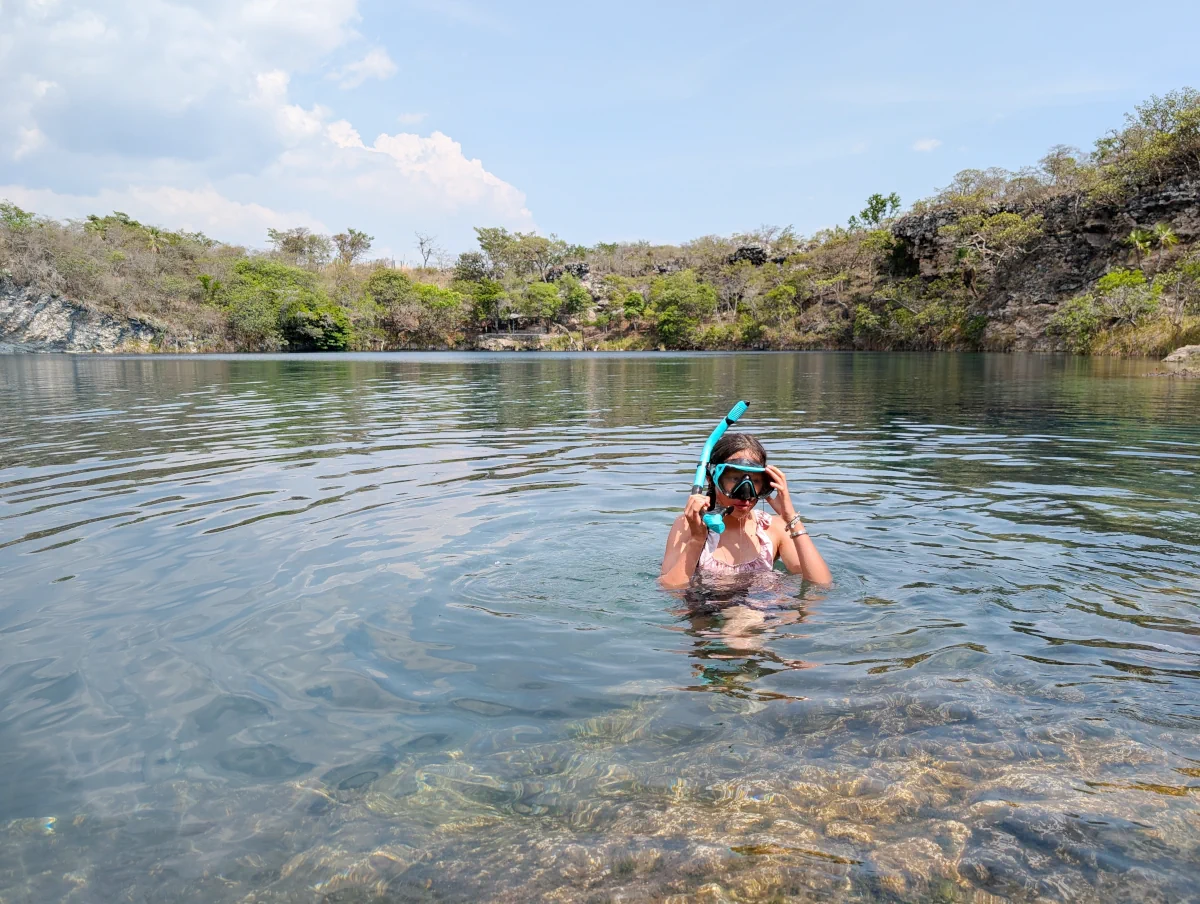
Despite feeling far from anywhere touristy, they rent out life vests and even a canoe — we didn’t use either — and there are a couple of picnic tables where you can prepare food and eat while watching the spiny-tailed iguanas on the rocks. That is all the facilities there are, so come prepared. In May it was very hot in the middle of the day, the edge is rocky, there are mosquitoes, and there aren’t many places to sit.
As we left, we were told you can camp beside a small hut whose tin roof extends over a concrete patio, a two-minute walk from the cenote. There’s a rudimentary bathroom and no other facilities. We weren’t prepared to camp that day — and we would soon be camping near other cenotes, at Montebello.
Las Peñitas: three cenotes on community land
At the end of August 2026 we went to three cenotes near the Lagos de Montebello. They’re just outside the national park — officially the Parque Nacional Lagunas de Montebello — on ejido (community-owned) land, where the local community has set up the Centro Ecoturístico Las Peñitas. It was simple to drive to: about 5 km, ten minutes, from the signposted Lagos de Colores.
Before you go: the UK government advises against all but essential travel within 40 km of the Guatemalan border in this part of Chiapas, and its own map puts the Montebello lakes inside that area. Chukumaltik, nearer Comitán, is about 40 km from the border, close to the edge of that zone. Travelling against that advice could invalidate your travel insurance. We’ve lived in Chiapas for years and drive through this zone often to visit family across the border. In 2026 the tour agencies were running Montebello trips again, and on one drive through I saw many Mexican families out exploring the lakes. That’s what I’ve seen, not a safety rating — read the current UK advice for Chiapas, or your own government’s, before you go.
The three are within a four-minute drive of each other, and with children they could hardly be more different. When I looked in September 2026, El Camarón was even marked as a lake on Google Maps.
Cenote Bartolo: a scramble down, and very deep water
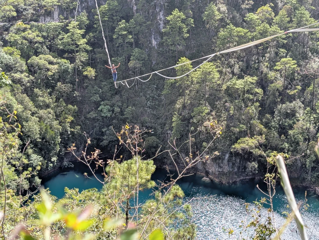
The first we visited was Bartolo, and it’s a serious drop from the ridge to the water, with no trail down. We followed steep, narrow, snaking trails that locals had made extracting timber until we were close to the water; from there my friends and I held on to trees and vegetation and slid down. I managed to help my children manoeuvre close to the water, but it was precarious, and I wouldn’t recommend taking young children down.
Cenote Bartolo · from the ridge, and the way down
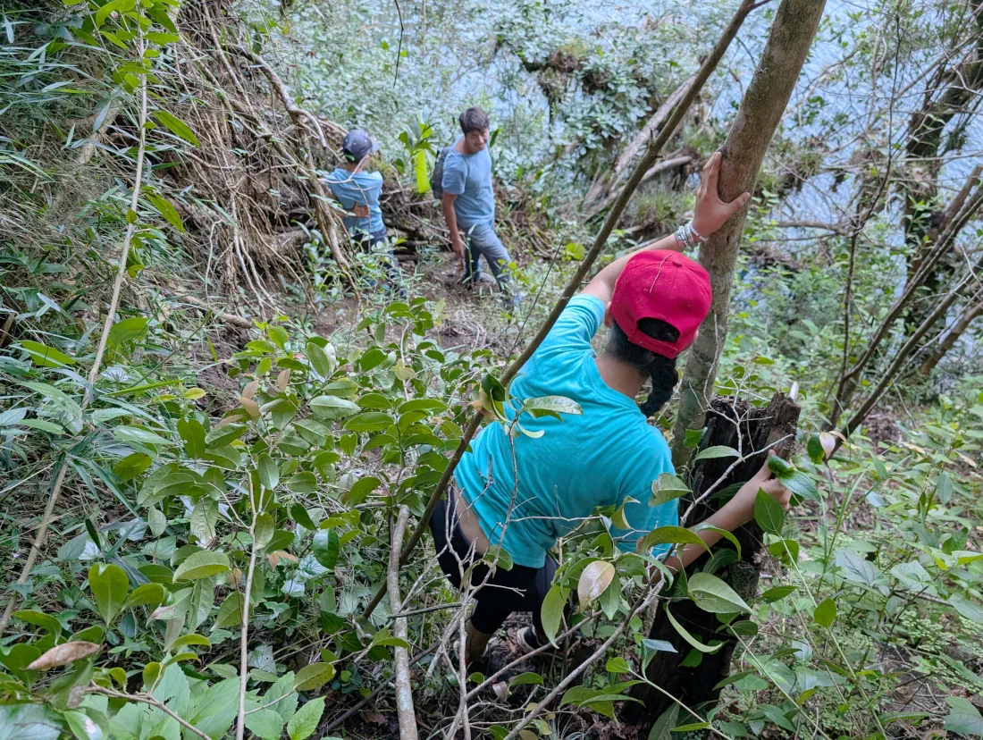
There was no flat ground at all at the water’s edge, which made getting changed and getting in difficult — in rain it would have been close to impossible. Only the adults went in, and it was dangerous. The dip was short and cold.
Hard to get in and out of, and immediately extremely deep.
There was the thrill of reaching something few people ever see — but for families, I’d recommend viewing the water from the ridge above.
El Camarón: the easy one
Inside a UK travel-advice zone — see Before you go.
The next cenote was a five-minute, 1.5 km drive along an unmarked track. It isn’t signposted; we found a rustic access area between two fields and parked there — a low car might not have the clearance and would have to be left on the main track. We followed a trail between the fields, and it turned out to be a well-defined path with handrails, leading down to El Camarón: an easy, short walk, descending through the trees to the water’s edge.
El Camarón · the path down, and the water
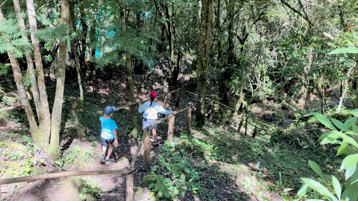
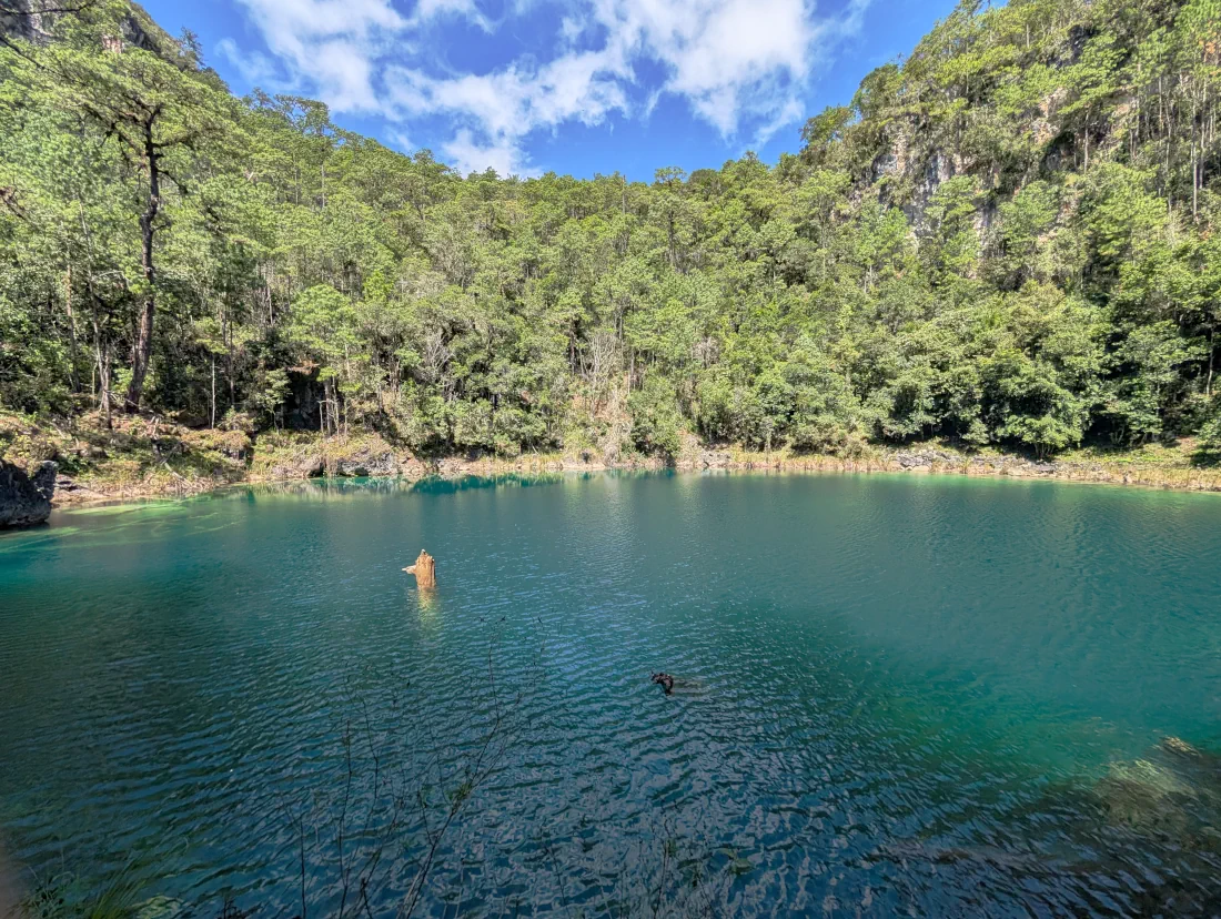
We arrived at an infrequently visited cenote, a secluded paradise: cold water, easy to get into for swimming and snorkelling, and places to relax around the edge. The children swam close to the edge, supervised. The water isn’t as clear as Chukumaltik’s — I swam across and looked down through my mask — but it was still incredible. There were huge fallen trees in the water, 10 to 15 metres from the bank. I don’t know how deep it is, but swimming across, the centre felt as if it could be very deep.
La Peineta: look, but don’t swim
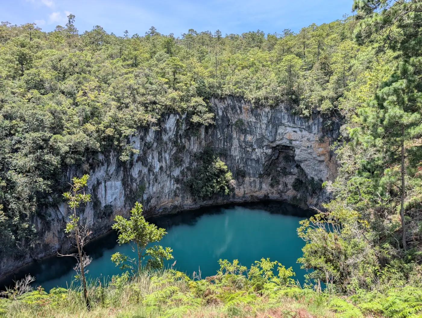
The last cenote is a one-minute drive further along the track from El Camarón. There’s a spectacular view of La Peineta a few seconds’ walk from the track — the photo at the top of this page — with rock-face cliffs on the far side. Locals told us swimming there is forbidden. We could also see an installation that local farmers use to pump water out for their crops. It detracted a little from the view, but it was still impressive.
Camping at Las Peñitas
Inside a UK travel-advice zone — see Before you go.
To explore the three cenotes, we camped beside a small lake that locals fish in and that you can swim in. It’s a picturesque spot, especially at dusk, with the lake in front and a seemingly endless expanse of cornfields running to a hilly horizon. Facilities were a couple of bathrooms where you flush with a bucket of water, and some large, well-built picnic tables with a roof. The ridge above Cenote Bartolo is a ten-minute walk away; with children, look from the top — there’s no trail down, and the water is immediately extremely deep.
They charge by vehicle, per day, and camping isn’t charged separately: MX$120 for our car. The second day’s fee was collected at 7:30 the next morning, so our night cost MX$240 (August 2026). There are no shops close by, so bring what you need.
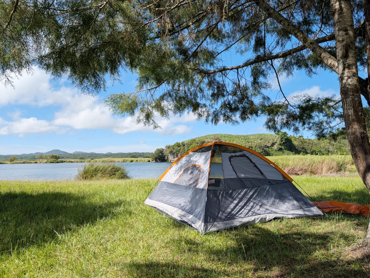
Be ready for wind and rain. We could hear the wind roar in the night. We were camped in a hollow, below the treeline behind us and the looming ridge that forms Cenote Bartolo, and it was still strong — I was a little concerned my Amazon Basics tent might not hold up and we would end up in the lake. The wind brought rain, even though Comitán and San Cristóbal were in the middle of a very dry few weeks.
Tie down the guy lines.
I was also glad I’d brought the lona I use as a groundsheet: the ground was very damp. My friends camped without one and were laughing about having wet backs over breakfast. The kit we always camp with is on its own page: camping in Mexico with two children.
A cave and a stone arch
Inside a UK travel-advice zone — see Before you go.
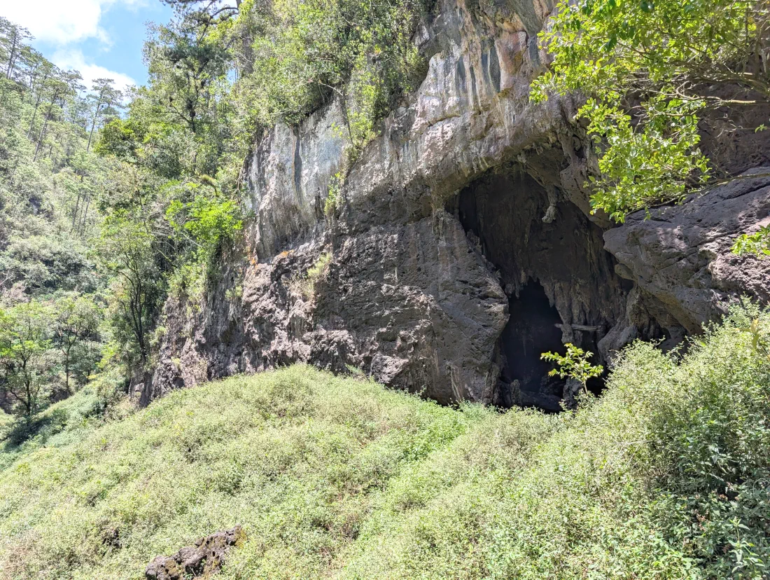
A local man told us there was a cave and a stone arch a short walk from the road, close to the cenotes — a few minutes’ drive on from La Peineta. The ten-minute walk in from the road was beautiful, through a forest of tall, quite epic pine trees. At one point the path splits: one way to the arch, the other to the cave directly behind it.
If you have never seen a place where people hold ceremonies in a cave, this is one. In my years in Chiapas I have learnt that people light coloured candles, sold in glass jars, to ask for almost anything — love, luck, a safe journey to the USA, even a curse on someone; the list is endless. What anyone asked for here, I can’t know; we saw only what they left. Fires had been burnt all around the front of the cave and inside it, and candles from recent ceremonies were still burning. It feels a bit spooky, with the candles, the glass and the burnt wood everywhere.
The cave itself is large but quickly becomes steep and slippery, and there isn’t a great deal to explore inside. The children explored around the river under the arch.
The cave and the stone arch · near Las Peñitas
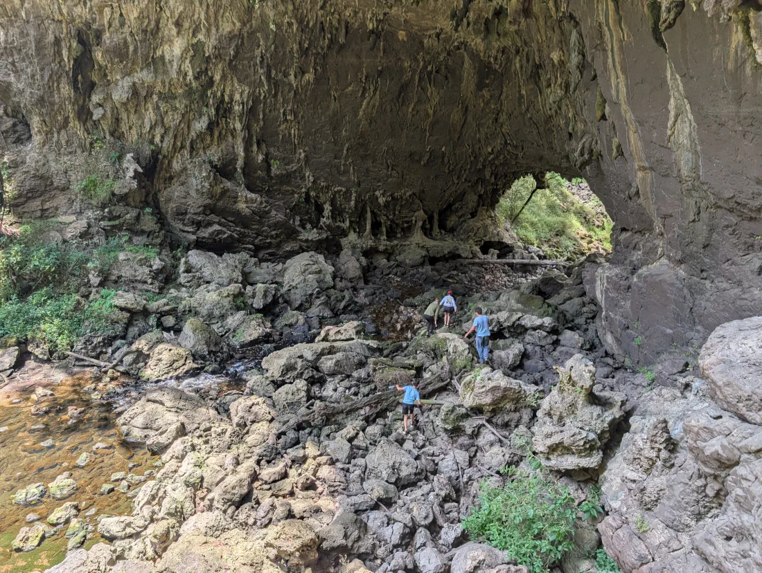
Leaving Las Peñitas, we drove past two lakes beside the road and stopped to take in the views. We didn’t explore them, and there are many more we could have visited with more time.
What we’d repeat, and what we’d do differently
Repeat: Chukumaltik, for the water — if you snorkel, I’d recommend it 1000%. El Camarón, for the easy path down and a swim the children could share. And a night by the lake at Las Peñitas, with three cenotes minutes away.
Differently: at Bartolo, I’d keep the children on the ridge and look at the water from above. At Chukumaltik, take everything your family needs to be relaxed and comfortable in the heat — there are picnic tables and not much else — and if your children aren’t strong swimmers, it may be worth hiring the life vests or the canoe. And at Las Peñitas, tie the tent down and bring a groundsheet.
If you can only do one: I’d still go to both — they’re about an hour apart, and they’re different experiences. Chukumaltik is an incredible day trip, close to the amenities of Comitán. The Montebello area has so many options — lakes, cenotes, camping, cabins — that I’d give it at least two days and visit as many lakes as you can. Together they’d make one long weekend, with Chukumaltik on the way; we did them as two separate trips, so that part is a suggestion rather than something we’ve tested.
Our ratings
Our family’s ratings — one visit each, May and August 2026, with our children aged 10 and 12.
How the Alternative Lives Factor works
The Alternative Lives Factor is our personal verdict on how rewarding we found an experience and what made it worthwhile. 5 means this is why we do it; 1 means it was not for us. The appeal, trade-offs and practical details help you judge what suits you. Each verdict reflects the dated visit described here.
Las Peñitas is inside a UK travel-advice zone, and Chukumaltik close to its edge — see Before you go.
Chukumaltik
The Alternative Lives FactorOutside the usual routes
5/5This is why we do it
Our visit · May 2026 · day trip · children aged 10 and 12
Water so clear you can watch the bottom drop away.
Who might enjoy it: Snorkellers who want to look down into very deep, clear water, with a short walk from the car.
The trade-off: It gets deep quickly at the rocky edge; mosquitoes, considerable midday heat and few places to sit.
With children: ours tried snorkelling but found the sudden depth disconcerting and stayed near the edge. Life vests and a canoe were for hire; we didn’t use them.
Access and restrictions: sandy roadside entrance, a short walk to the water; a couple of picnic tables, and no other facilities (May 2026).
What we paid: MX$40 a person, entrance (May 2026).
El Camarón
The Alternative Lives FactorOutside the usual routes
5/5This is why we do it
Our visit · August 2026 · from our camp at Las Peñitas · children aged 10 and 12
A secluded paradise down an unmarked track, and the children in the water.
Who might enjoy it: Swimmers looking for a secluded forest cenote with a short, handrailed path down to the water.
The trade-off: The approach is unmarked, and facilities are minimal.
With children: the one I’d bring them back to — a short path with handrails, and they swam close to the edge, supervised, while I swam across with my mask.
Access and restrictions: unmarked track, 1.5 km on from Bartolo; park between two fields (a low car may need to stay on the main track), then a well-defined path with handrails (August 2026).
What we paid: covered by the Las Peñitas day fee.
Camping at Las Peñitas, with the walk to Bartolo’s ridge
The Alternative Lives FactorOutside the usual routes
4/5Our kind of experience
Our visit · August 2026 · one night · children aged 10 and 12
The lake at dusk, cornfields running to a hilly horizon — and a ten-minute walk to look down into Bartolo.
Who might enjoy it: Campers who want a simple base for exploring the cenotes.
The trade-off: Wind, rain and damp ground on our visit; bucket-flush bathrooms and no shops nearby.
With children: the ridge is the way to see Bartolo with them. We scrambled down once — precarious, and the water is immediately extremely deep; only the adults swam. Pitch for the wind, too: it came up in the night.
Access and restrictions: drive in and pitch your tent anywhere around the small lake. Bartolo’s ridge is a ten-minute walk; there’s no trail down to the water — only timber-cutters’ paths, then holding on to trees (August 2026).
What we paid: MX$120 per vehicle per day, camping included; the second day was collected at 7:30am — MX$240 for our car, one night (August 2026).
The cave and the stone arch
The Alternative Lives FactorOutside the usual routes
3/5Glad we went
Our visit · August 2026 · a short walk from the road · children aged 10 and 12
A local man’s tip took us through tall pines to a cave where people still hold ceremonies.
Who might enjoy it: Walkers interested in tall pines, the cave and the stone arch.
The trade-off: The cave becomes steep and slippery; boulders can be awkward for small children.
With children: good for the walk and the river under the arch; the cave gets steep and slippery quickly.
Access and restrictions: about ten minutes’ walk from the road through tall pines; the path splits for the arch and the cave behind it (August 2026).
What we paid: nothing.
Been recently and found the access, the fees or the swimming rules changed? Email me with what you found and the date you went.
— Luke Burchell
Follow along
I email new articles as I publish them. Subscribe if you’d like to read the next one.
Family trips outside the usual routes
 Our river near TuxtlaBalneario Isla de María: our river escape near TuxtlaA warm river 80 minutes from San Cristóbal, for a day by the water or a night under the palms.
 A longer coastal tripCamping on the Oaxaca coast with two childrenA ten-hour drive, a reef with turtles, and how we handled the lowland heat.
 Packing listWhat we take camping with children in MexicoThe ten things we always carry, and five years of trips to a thermal river in Chiapas.
All trips & stories → · Another field note: the stove I built to keep families warm → · Who’s behind Alternative Lives → · Home